


Cynthia Voting District, Hinds County, Mississippi
About
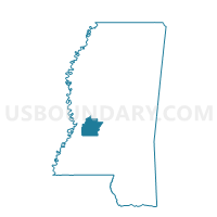
Outline

Summary
| Unique Area Identifier | 605605 |
| Name | Cynthia Voting District |
| County | Hinds County |
| State | Mississippi |
| Area (square miles) | 18.05 |
| Land Area (square miles) | 17.93 |
| Water Area (square miles) | 0.13 |
| % of Land Area | 99.30 |
| % of Water Area | 0.70 |
| Latitude of the Internal Point | 32.41211060 |
| Longtitude of the Internal Point | -90.26890060 |
Maps


Graphs
Select a template below for downloading or customizing gragh for Cynthia Voting District, Hinds County, Mississippi


Neighbors
Neighoring Voting District (by Name) Neighboring Voting District on the Map
- Voting District 83, Hinds County, MS
- Voting District 84, Hinds County, MS
- Lorman-Cavalier Voting District, Madison County, MS
- Pinehaven Voting District, Hinds County, MS
- Pocahontas Voting District, Hinds County, MS
- Tinnin Voting District, Hinds County, MS
Top 10 Neighboring County Subdivision (by Population) Neighboring County Subdivision on the Map
- District 1, Hinds County, MS (51,455)
- District 2, Hinds County, MS (43,374)
- District 3, Madison County, MS (22,721)
Top 10 Neighboring Place (by Population) Neighboring Place on the Map
Top 10 Neighboring Unified School District (by Population) Neighboring Unified School District on the Map
- Jackson Public School District, MS (169,340)
- Madison County School District, MS (74,118)
- Clinton Public School District, MS (29,115)
Top 10 Neighboring State Legislative District Lower Chamber (by Population) Neighboring State Legislative District Lower Chamber on the Map
Top 10 Neighboring State Legislative District Upper Chamber (by Population) Neighboring State Legislative District Upper Chamber on the Map
Top 10 Neighboring 111th Congressional District (by Population) Neighboring 111th Congressional District on the Map
Top 10 Neighboring Census Tract (by Population) Neighboring Census Tract on the Map
- Census Tract 105, Hinds County, MS (7,812)
- Census Tract 303.02, Madison County, MS (6,304)
- Census Tract 103.04, Hinds County, MS (6,149)
- Census Tract 102.03, Hinds County, MS (2,917)
- Census Tract 302.06, Madison County, MS (1,980)